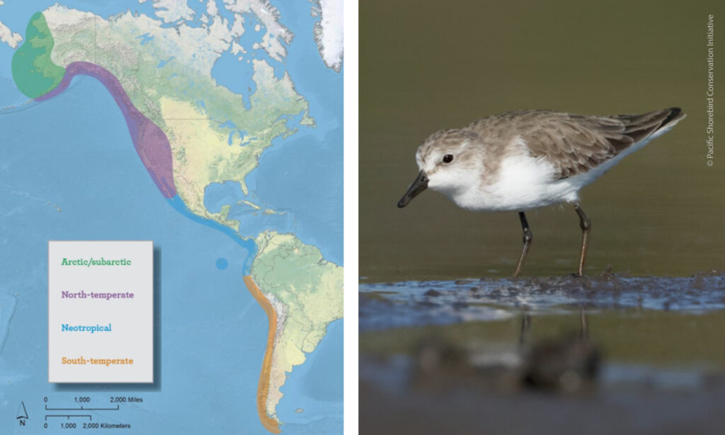
Every year, Northwestern Mexico is the scene of an extraordinary event. When winter arrives, millions of birds from North America travel south in search of temperate weather, shelter and food. They flock thousands of kilometers along the Pacific Flyway, which extends more than 16,000 kilometers from the Arctic breeding grounds to the wetlands and mudflats of Mexico, Central and South America. However, this phenomenon exposes migratory birds to multiple environmental threats, such as urban encroachment, pollution and climate change, and some are at risk of disappearing. In fact, it is estimated that 35% of migratory birds worldwide have disappeared in the last 50 years.
Northwest Mexico is a transition zone in the birds’ long journey along the Pacific coast. Many of the birds pass by and continue their journey south, but others, many others, stop here and occupy our coasts and wetlands as their temporary habitat. That is why we at Pronatura Noroeste collaborate in a multinational coordination alliance known as the International Shorebird Conservation Strategy for the Pacific Flyway of the Americas. This strategy links governments and environmental organizations for the study and knowledge of migratory birds and their ecosystems.
Those who implement the international strategy strategy participate in the continental conservation agenda and act at the local level. In this way, we generate solid and updated information to restore and maintain migratory bird populations in our region, and therefore, throughout the continent. This alliance is made up of national, state and local governments, conservation groups, universities and civil organizations.
One of the activities carried out on a large scale is the creation and dissemination of narrative maps of bird migration, which allow us to measure the threats that these incredible species face in order to fulfill their life cycle. The interactive document presents maps of 28 partner projects, organized into seven conservation strategies, with a metrics dashboard summarizing the impacts of each project and a summary of their achievements. In this way, at the continental level, a difference is made in the conservation efforts of shorebirds in our continent.

As Pronatura Noroeste, we contribute two projects to this strategy, focused on the period spent by the more than 250 species of migratory birds in our region. The first is a study on the effects of sea level rise on shorebird habitat. This research work is relevant because it is estimated that in the next century global warming will cause a rise in sea level between 0.3 and 1.2 meters, which will radically change the coastal habitat. The study focuses on estimating the effects of rising sea levels on shorebirds and their habitats at both regional (northwestern Mexico) and local (Guerrero Negro) scales.
The second is our participation in the Motus network of stations for migratory monitoring. This consists of the installation of automated radio telemetry antennas that detect birds carrying tiny transmitters on their legs. This provides a record of the birds’ journey, their arrival and departure times, as well as their routes along the continent and the sites chosen for food and rest. In January 2021 we will install the first Motus station in the Punta Banda estuary, south of Ensenada. By March 2022 we have 14 stations in operation, with the goal of completing a network of 24 stations distributed in the 15 coastal wetlands of the region.
Both projects are led by Julián García Walther, coordinator of the Motus initiative at Pronatura Noroeste and doctoral candidate at the University of South Carolina.
Learn more about our migratory bird conservation work and visit the Pacific Shorebird Conservation Initiative.
Link to StoryMap: View the StoryMap


